Best jQuery Maps Plugins & Tutorials with Demo

    jQuery Advance Route Planner API

    jQuery Advance Route Planner API

    Advance Route Planner is a A to B RoutePlanner tool written in Pure Javascript with Google Map Ver. 3 API.

    Features:

    • Responsiveness.
    • Google Adsense.
    • Drag-able Route, adjust route as per your requirement.
    • Share able Link Generator.
    • Print button.
    • Change Google Map Language.
    • Fix your starting / ending point with ease and get proper Route Directions in details via Google API.

    Heatmap jQuery plugin

    Heatmap jQuery plugin

    Heatmap is a simple jQuery plugin to display the visualization of proportion data corresponding to geometry locations.

    Smallworld.js : jQuery Plugin for Generating Small World Maps

    Smallworld.js : jQuery Plugin for Generating Small World Maps

    Smallworld.js is a utility for generating map overviews using GeoJSON and HTML Canvas. It was created out of a need to render simple map previews, quickly and efficiently, without strict Terms of Use and without heavy client libraries.

    The utility has no dependencies, weighs ~5kb (sans GeoJSON), and also comes with a simple wrapper to use with jQuery or Zepto.

    StatMapSVG : Statistical Map SVG & jQuery

    StatMapSVG : Statistical Map SVG & jQuery

    StatMapSVG is a jQuery plugin to display statistical data in the form of a map such as the number of people in each area, the location and distribution of data, grouping data based on the value of a specified interval, and others. StatMapSVG takes map files in SVG format and makes them interactive. You can use StatMapSVG for country maps, province maps, city maps, floor plans and others.

    jQuery Geolocation edit Plugin

    jQuery Geolocation edit Plugin

    jQuery plugin for editing latitude/longitude pair with Google Maps window. Features (optional) geocoding of address text with Google Geocoding API.

    GeoDirections – Useful Geolocated Directions Map

    GeoDirections - Useful Geolocated Directions Map

    GeoDirections is a simple but useful and customizable geolocated directions map. It allows you to create a “target marker” (for your office, your shop or whatever you want) so when your user / customer wants to find you, he is automatically geolocated and a direction between you and him is drawn.

    wayfinding : jQuery plugin for Interactive svg maps

    wayfinding : jQuery plugin for Interactive svg maps

    A jQuery plugin that will provided shortest route through a series of one or more svg maps from a given start location to a destination using routing information encoded into the svg file.

    This plugin can be useful for kiosks and interactive digital signage.

    Twism : A clickable SVG maps jQuery plugin

    Twism : A clickable SVG maps jQuery plugin

    Twism is a clickable SVG maps jQuery plugin.Well, it works for any SVG that has IDs on the clickable regions. I made it for rolling out quick maps, though. You should probably use D3.js or Raphael if you want a robust, tested library for manipulating vector graphics.

    Mappy.js : Google Maps & Places jQuery plugin

    Mappy.js : Google Maps & Places jQuery plugin

    I couldn’t find anything that fully did what I was after so I built mappy (besides I need the JavaScript practice!).

    In short it provides the following:

    • UI for users to “select” a place (you get a callback detailing what they picked)
    • UI for adding “custom” places
    • Support for firing a map up full-window (without having to create a DIV on the page)
    • Add searching to the map
    • Add/Edit and update your own “custom places” (i.e. not those in the Google Places API doesn’t know about, but you do)
    • Works with multiple maps on the same page

    jQuery Location Picker plugin

    jQuery Location Picker plugin

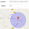
    This plug-in allows to easily find and select a location on the Google map. Along with a single point selection, it allows to choose an area by providing its center and the radius. All the data can be saved to any HTML input element automatically as well as be processed by Javascript (callback support).

    Features:

    • Doesn’t require JQuery UI. The only requirements are JQuery and GoogleMaps API
    • Allows to pick an area with specified radius
    • Automatical binding to UI components (bidirectional data exchange)
    • Autocomplete for address input
    • Navigation by cordinates as well as by address